July 24, 2024
Our Cities Need More People Near Frequent and Rapid Public Transport
Traditionally, the quality and reach of a city’s public transport system is measured in number of kilometers, number of stops, ridership, or speed. These metrics can certainly show planners and policymakers a lot about the progress of their urban infrastructure.
This is ITDP’s Year of the Bus — learn more about why access to public transport is critical to our urban future.
However, these metrics do not fully account for the fundamental purpose of public transport — to make cities more accessible to the most amount of people. This is why city planners should use measurements such as People Near Frequent Transport and People Near Rapid Transport, both included in ITDP’s recently released Atlas of Sustainable City Transport, as official goals to measure the progress of public transportation.
Access Matters
In many cities, people rely on walking, cycling, and public transport as their primary means of mobility for accessing jobs, education, healthcare, or other daily destinations. At the same time, less than half the world’s urban population has convenient access to their public transport systems locally. This inaccessibility can result in more complicated or less safe commutes, higher costs, and potential exclusion from key economic and social opportunities for the many communities without access to any other means of transport.

In addition, access to public transport (or the lack thereof) can have far-reaching effects on health and health equity. In a general sense, more high-quality and accessible transport options can reduce the number of vehicles on the road, leading to lower emissions and fewer traffic fatalities. Public transport can also affect health more indirectly by providing access to health-promoting services and resources. Access to reliable public transport can promote other forms of sustainable mobility, such as walking and cycling, through transit-oriented development measures that provide viable and sustainable alternatives to private vehicles. In addition, promoting active mobility in tandem with public transport can result in economic and climate benefits that enhance the quality-of-life and wellbeing for all urban residents.
Of course, accessible transport systems need to go together with fast and reliable service in order to sustain ridership and investment. This is why ITDP’s Atlas spotlights the key indicators of People Near Frequent Transport and Rapid Transport, and not just public transport in general or transport where vehicles in mixed traffic come less often than every 10 minutes throughout the day. These indicators can offer everyone from decisionmakers to advocates with a deeper and more meaningful understanding of not just the accessibility of transport systems, but also the quality of the services people can reach.
Why Frequent Transport?
In the Atlas, People Near Frequent Transport measures the percentage of an area’s population living within walking distance (500 meters) of a transport station with service in both directions, as well as 10 minutes or less between vehicles during weekday services. Such frequent service is what makes transport reliable enough that people can comfortably use it for their daily needs, without worrying about what will happen if they miss the bus or train. Frequent transport is key to connecting different city neighborhoods to all residents, including those with mobility impairments or young children, to reach the wide variety of destinations necessary for a fulfilling life. Prioritizing frequent service requires cities to focus on transport integration and planning that supports growing population densities and compact neighborhoods both now and into the future.
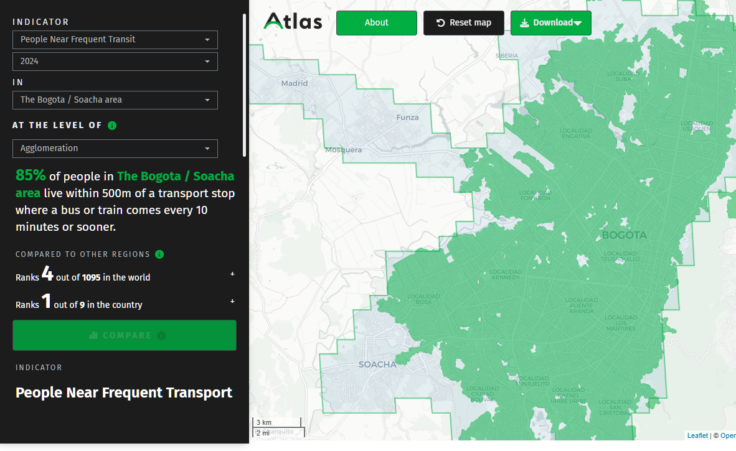
One of the highest-ranking metropolitan areas for People Near Frequent Transport in the Atlas is Bogotá, Colombia, which has been widely recognized for its commitment to comprehensive and sustainable transport, particularly with its landmark TransMilenio rapid transit system. A two-time recipient of the Sustainable Transport Award, the Atlas’ 2024 data finds that nearly 85% of people in the Bogotá/Soacha area live within a walkable distance to a transport stop with frequent service. This is all the more impressive given that the region is home to over 11 million people and Bogotá proper has one of the highest population densities globally. In fact, cities like Bogotá that are denser and more compact make a case for the cost-effectiveness of prioritizing quality and rapid public transport services over private vehicles.

Why Rapid Transport?
People Near Rapid Transport measures the percentage of an area’s population living within one kilometer of a rapid transport system. The Atlas measurement includes all forms of high-capacity public transport that run at high speeds in their own separate paths, such as metro trains (like subways), light rail, and bus rapid transit. As with most other Atlas indicators, the one kilometer is calculated in terms of walking distance along walkable streets or paths.
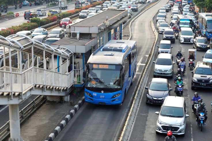
Because rapid transport bypasses traffic congestion, it can be the fastest way to move around a city and serve an essential function of public transport — to move more people further and faster than individual vehicles. And, in many global cities where metro rail is too costly to build or not available, bus rapid transit systems are the most effective form of rapid transport services. Rapid transport that is well-integrated with walking and cycling networks are particularly useful for allowing people to take more reliable and connected trips that reduce the need for cars, lower emissions, and streamline commutes.
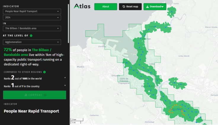
For example, according to Atlas’ 2024 data, the metropolitan area of Bilbao, Spain is the second-highest ranking for People Near Rapid Transport in the world. Nearly 72% of people in the Bilbao/Barakaldo area live within one kilometer of high-capacity public transport running on a dedicated right-of-way corridor. In recent years, Bilbao has been investing into both sustainable and active mobility infrastructure by extending its cycling networks, deploying electric bus fleets, and prioritizing road safety and traffic taming measures. The Bilbao Metro is the most widely used rapid transport system in the region, complimented by a tram network and the Bilbobus municipal bus system. This expansive access to public transport has had a demonstrated impact — Bilbao now has the lowest rate of private vehicle use of any city in Spain.

A city’s public transport system is only as good as the people and communities it can serve and reach. Access to public transport can have a far-reaching influence on people’s productivity, economic outcomes, education and healthcare access, and so much more. Thus, it is not just the length of a system or the number of stops that matters, but the quality of frequent and rapid service and the accessibility across neighborhoods.
At a structural level, the Atlas’ indicators help to show how cities can better allocate their funding and resources to connect more people to more destinations, support multi-modal trips, and prioritize infrastructure projects that benefit all communities. Cities around the world have begun to use People Near Transport as an official policy goal in planning and developing their regional transport systems. For example, the city of Seattle, USA, adopted a very similar metric as a primary target in their mobility strategy.
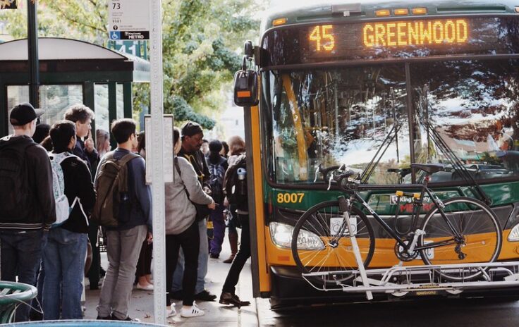
Between 2016 and 2018, Seattle actually improved transport service and increased the percentage of residents near frequent transport from 25% to 68%. Note that, while these percentages are slightly different than the Atlas because the details of the methodologies are different, the primary takeaway is that Seattle became the only major US city to increase its transit ridership in that same time period. Across the world, the city of Pune, India has also notably made use of People Near Transport to inform the reach and progress of its transport plans, demonstrating that all types and sizes of cities can put these concepts into practice.

Released earlier this year, the Atlas of Sustainable City Transport is a first-of-its-kind user-friendly geospatial database of nine indicators measuring what matters for sustainable transport in cities. The Atlas is based on open sources of data, and, in turn, all the data in the Atlas is available for free download. ITDP plans to update it annually and track the progress of cities over time.
The Atlas includes data for over 40,000 administrative jurisdictions in over 1,000 metropolitan areas worldwide. Learn more about how you can turn the Atlas’ data into policy measures in your city.
