May 15, 2024
In What Cities are People Safest from Highways, and Why Does It Matter?
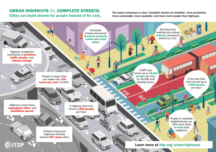
It is no secret that grade-separated highways can cause a lot of harm in cities.
They exacerbate air pollution, divide neighborhoods, and increase the risk of road injuries and deaths. The closer people live to large highways and roads, the more susceptible they are to these hazards and, oftentimes, these are already low-income or marginalized populations. Urban highways are the ultimate manifestation of a history of development that has prioritized the movement of cars above all other environmental and social factors. The United States is perhaps the primary model for this history, and has contributed to spreading this same trend worldwide.
Fortunately, there are still cities not yet dominated by highways. ITDP’s newly launched Atlas of Sustainable City Transport dashboard can help us find them. The Atlas presents indicators for sustainable transport for metropolitan areas and jurisdictions around the world, allowing planners and policymakers alike to draw comparisons for improving urban transport. One of these key indicators is focused on People Safe From Highways by measuring the percentage of an area’s population not living nearby (within 500 meters of) a grade-separated highway. Using the Atlas’ open source data, we can see which cities have fewer people living near grade-separated highways. That is, we can identify the places that still have a chance to avoid following the mistakes of US cities.

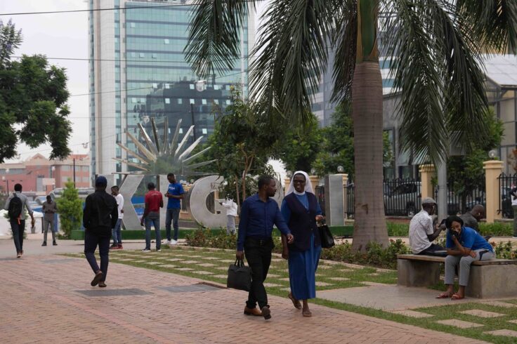
Based on the Atlas’ data, cities in Africa rank especially high in the People Safe From Highways indicator, with the top five all being located within African countries. In fact, some African cities have no grade-separated highways at all. The city of Kigali, Rwanda, for example, has an incredible 85% of its over 1.7 million people safe from highways, more than almost any city in Europe outside of the former Soviet Union Bloc countries. While some might imagine that European countries would score higher in this indicator, unsafe roads are still a major concern across the European Union.
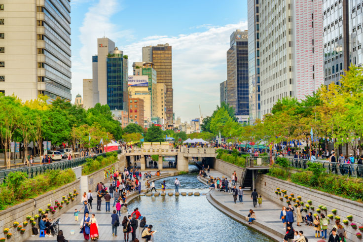
Some cities around the world have spent enormous sums of money building urban highways only to tear them down a few decades later. In places like Seoul, South Korea, the removal of urban highways has created beautiful public spaces, boulevards, or parks. But wouldn’t it have been more economical to simply not build the highways in the first place? Cities with high measurements on People Safe From Highways have the opportunity to avoid this mistake.

African cities also tend to score highly on Population Density. In denser areas, destinations are usually closer and easier to walk to. Several African cities have surprising strength in three of the primary Atlas metrics that measure the most fundamental elements of a city’s walkability. Another one of these indicators is Block Density, the average number of city blocks in a square kilometer. Block Density is crucial for walkability: in cities with smaller blocks, it is easier for people to find a direct walking route to their destination or to public transit, limiting exposure to vehicle traffic. Of the top ten cities in the world ranked by Block Density, nine of them are in Africa.
People Safe From Highways, alongside Block Density and Population Density, help form the foundation for more walkable cities. But just because African cities score highly on these indicators does not necessarily mean they are safely walkable. For a city to be truly walkable and people-oriented, high densities and connected neighborhoods must be supplemented by infrastructure such as wide, level, and shaded sidewalks, spaces, and intersections.
Of course, while removing highways will help reduce traffic accidents, improving overall road safety requires a myriad of measures. This includes well-designed infrastructure, speed management policies, parking reforms, and more. Many African cities still lack safe sidewalks and crossings—crucial factors that the Atlas is not able to account for.

Nevertheless, many of these cities in Africa and around the world have the crucial foundations and opportunities to plan for safer, more accessible neighborhoods—things which are lacking even in wealthier regions that have been designed around cars for too long. These African cities and their governments have the data and opportunity to focus on more equitable and sustainable infrastructure.
The Atlas helps to provide evidence of where this is possible and, as ITDP will continue updating the Atlas annually, it will help cities track their progress. But it is up to the planners and policymakers to take this myriad of data and apply it directly to making better decisions for the good of their communities.
Find more updates to Atlas-related content and resources here and join the debut webinar here.
