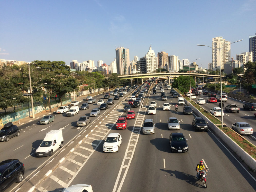
 In São Paulo, sprawl is commonplace with affordable housing placed far away from commercial districts.
September 11, 2020
Access: What Does It Tell Us?
Transit can be measured in kilometers, number of stops, ridership, speed. While these metrics are important and can be illuminating, they cannot quite fully capture the utility of a transit mode. That is where access comes in: an opportunity to measure the connection, distance from transit, but more importantly, how many places one can reach using transit.
Transport: Rethinking through an Access Lens
In Brazil, transport is studied as planning for roads, commutes, transit modes. Transport includes how many trips people take, where the trips go, and by which mode. Mobility, on the other hand, includes active modes like walking and cycling and analyzes potential access to a city. Mobility is viewed as a broad discipline and may include access, but generally doesn’t encapsulate the idea of how easy it is to get to places, and how many places are close by. Access is about how quickly one can get to many places using transit.
The value of measuring access is that it can more successfully impact policies and actions as they relate to city residents. “Access helps to explain the inequality of access to opportunities available to citizens, creating a more inclusive horizon of action; after all, the concept of justice assumes equality of opportunities.” Explains Rafael Pereira, an Ipea (Instituto de Pesquisa Econômica Aplicada) researcher and the coordinator of Access to Opportunities Project. Pereira continued, “The more accessible a city, the better, because this means that a large part of the population has what it needs or wants within reach. On the other hand, it cannot be said that increased mobility (number of trips) is necessarily good, because this can mean that individuals are being compelled to take more trips than they would like to or use means of transport they do not wish to use. The increased number and extent of trips means greater environmental impacts with the consumption of natural resources, greenhouse gas emissions, and local pollutants.” In other words, metrics used might not paint a full picture of how mobile a city really is. More trips does not mean that people are traveling efficiently, it could mean the opposite.
Access, on the other hand, relates to how many opportunities and services are within a resident’s reach by transport modes. This notion is sometimes overlooked by traffic engineers and managers who see transport as a tool that serves to move people through infrastructures within a supposedly consolidated environment, they view this tool separate from urban planning. The reality is that for transport to be good, it must be accessible.
Additionally, aspects of urban policy that are related to transportation are often viewed without an accessible lens. For example, in Brazil, housing policy is approached as a lack of housing for people and the solution is to build more housing units. This solution, however, creates its own challenges. Sometimes, these new housing developments are built in regions far from the city and without any accessible public transport to places that residents would need to go. Building housing separate from reliable, affordable transportation options leaves the population without access to services and jobs. As a result, the lower income population is then forced to spend a disproportionate amount of time and money on transportation compared to residents who have better access.
Including access in everything from short to long term planning creates a lens for equity in development. While seeing results in this planning may not be immediately obvious, having services and opportunities closer to the people who use them will be significant in the long term. Pereira suggests that even short term fixes can be impactful, “For example: by observing that the population of a given region spends a lot of time traveling to a given service, planners can increase bus frequency along this route or offer additional lines to improve the service for these residents.” Temporary interventions, often referred to as tactical urbanism projects, can be used to pilot near-term access improvements, improving safety and comfort for people walking and cycling.
By studying the access people have to services throughout the city, urban planners can design and build transit stations in places where people can access them most easily. Investing in building transport infrastructure in less favored regions can provide access to those who did not previously have it. Rather than asking how many kilometers of transit are needed, planners can ask: where is the best location for these kilometers of transit to best meet the needs of its riders?
ITDP’s new report, From Pilot to Permanent: How to Scale Tactical Urbanism using Lessons from the Global South, gathers lessons learned from temporary interventions in São Paulo, Jakarta, Chennai, and other cities, and offers recommendations to help ensure that temporary interventions are designed with local communities, adjusted in response to feedback, and eventually made permanent.
Access to Opportunities Project
Using access as a factor in planning demands a way to measure access. ITDP Brazil has studied access in 20 Brazilian cities, determining what still challenges residents and what improvements can be made to policy.
“Access can be essentially understood as a ‘potential’. In other words, how easily a citizen or group can access certain services or opportunities available in the city for a certain cost of time”, explains Bernardo Serra, Policy Manager at ITDP Brazil. This January, ITDP launched the Access to Opportunities Project, along with Ipea. This study mapped the access of people in 20 of the largest Brazilian cities and is slated to be updated annually until 2022. Containing an interactive map, a report with main findings, and an open database, the project provides an overview of access to job opportunities, as well as healthcare and education opportunities by different transport modes. These results can support more effective and inclusive public transport and urban policies.
Using access as a metric represents a major improvement to better understanding how people interact and use transportation in Brazil. Since 2017, ITDP Brazil has used the MobiliDADOS Platform to share indicators like the percentage of residents living near (and, thus, are likely to use) rapid transit stations (People Near Transit – PNT) or cycle paths (People Near Bikeways – PNB). These data enable cities to better understand where access is low, so that they can make evidence-based decisions about where to target investments to improve access to public transport and safe cycling infrastructure. The fact that these data are publicly available serves to hold governments accountable that consistently overlook such access gaps.
The Access to Opportunities Project concluded that on a city level there are two major pillars of shift needed to improve access. Policies based on Transit-Orientated Development (TOD) and the Avoid, Shift, and Improve strategy. TOD strategy entails the creation of compact cities, with good population density, diversified land use, and prioritizes active and collective modes of transportation. Avoid, Shift, Improve proposes actions to reduce the use of automobiles by reducing unnecessary travel, shifting to more efficient modes, and improving technology. These principles are closely linked and in tandem result in cities where opportunities are closer and connected to resident’s homes.
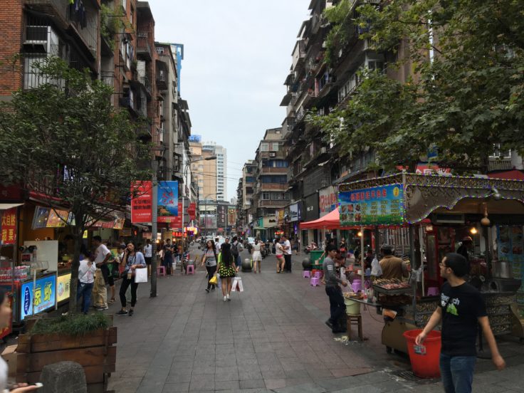
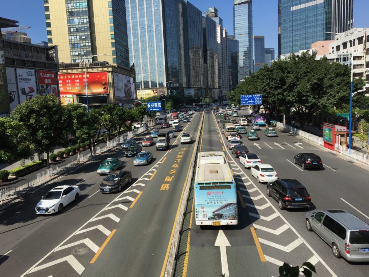
In Guangzhou, a pedestrian plaza provides easy to access walking space for people. A BRT corridor, through its priority highway access, can deliver people to their destinations more quickly.
Access and Opportunities: Next Steps
The Access to Opportunities Project aims to expand the number of cities with available information. In 2020, the expectation is to increase from 20 Brazilian cities to at least 30. In addition, researchers wish to add other services and opportunities like access to health, work, and education into the analyses. In Brazil, Ipea is also likely to conduct impact assessment of transport and urban development projects, in partnership with the Ministry of Regional Development. “We intend to analyze two projects already implemented and another two that are in the implementation stage. The objective is to consider the concept of access in decision making,” explains Rafael Pereira.
The concept of access provides consideration of the socioeconomic reality of people in urban planning and transportation decisions. By highlighting equal opportunities as the objective of public policies, access enables cities to become more balanced and offer better living conditions to all city residents.
Proximity is the ultimate way to provide access. In an ideal city, all the necessary opportunities, and services are near people’s homes. The option of traveling by more distant regions can serve to broaden this freedom of choice, but should not be requisite for basic needs. This ideal city does not exist, but access can help to analyze the conditions of real cities, facilitating the development of more appropriate, effective solutions and policies to allow potential life in cities to blossom.

